Summer isn’t always easy in Australia, but if you need a map to help you plan what you’re doing, Google Maps will be tracking bushfires in real-time.
While the holiday season is upon us, one season we’re not looking forward to is bushfire season, something brought on by hot and dry weather.
It might not seem like it now, particularly if you have the wet rainy La Niña affecting you, but the risk of a bushfire season is clearly strong, and something that poses a threat to many Australians living with the fear and frustration of previous years.
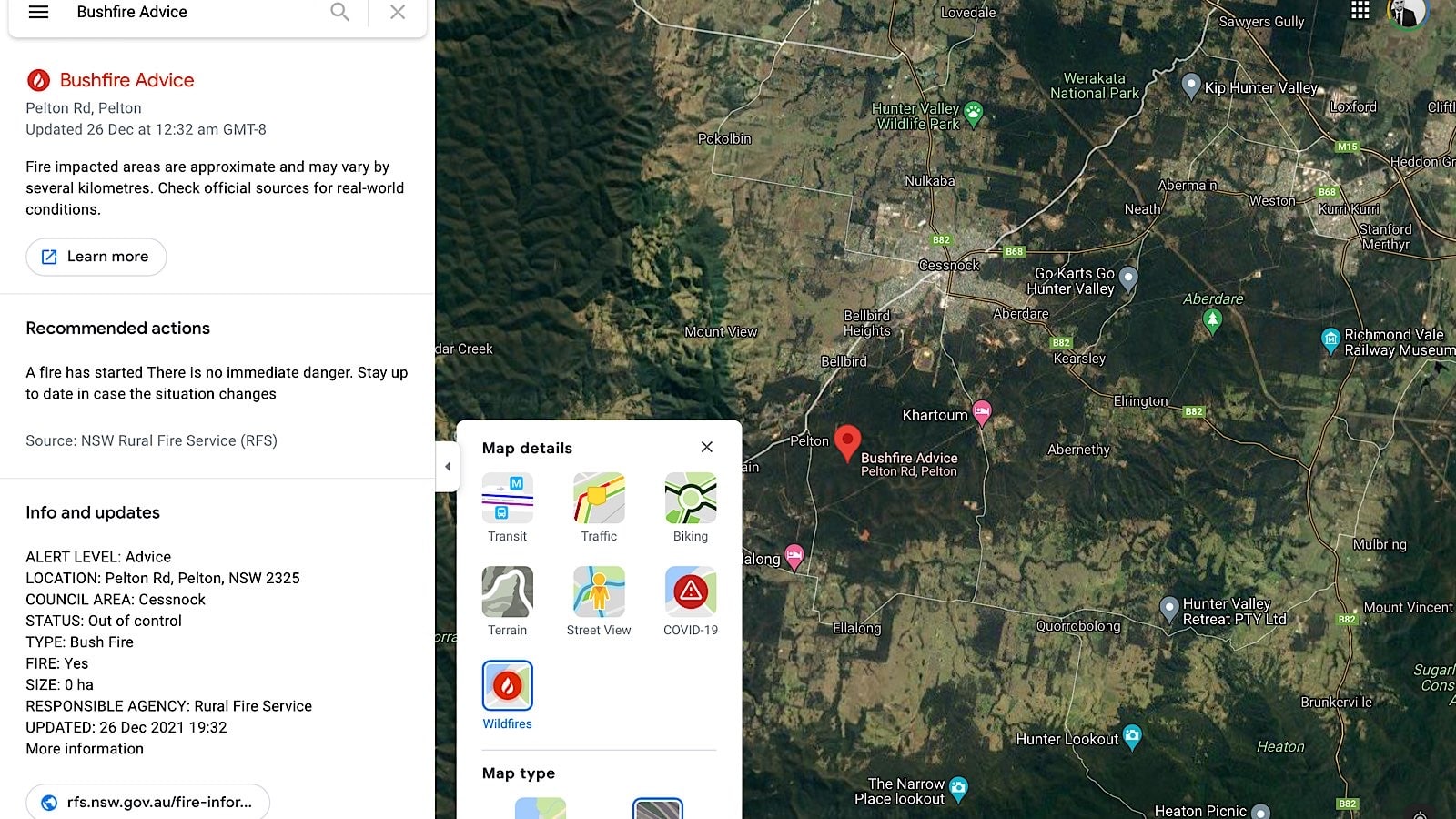
Even though there’s very little that technology can do to necessarily sole bushfires just yet, Google has come up with one method to keep everyone alert, adding a bushfire layer to its mapping platform, Google Maps, providing up-to-date details about bushfires across the country when needed.
The new layer forms a part of what’s available on Google Maps alongside traffic, transit, biking, COVID-19 alerts, and terrain, and works across Android, with Google noting that it’s working with local fire agencies and other organisations to help keep the information current, while also talking to WWF and the University of Queensland to coordinate wildlife recovery alerts, as well.
It’s just one more thing your mapping platform can do, and may well be something else you can rely on.